1. The Majesty of Kanchenjunga: Why the Third Highest Peak is Nepal's Ultimate Wilderness Trek
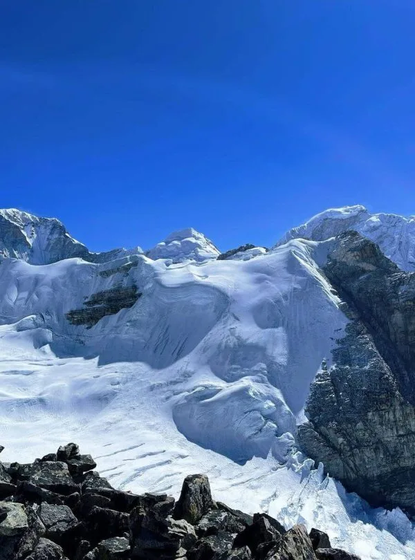
Towering majestically along Nepal’s eastern border with the Indian state of Sikkim and the Tibetan Autonomous Region, Mount Kanchenjunga (8,586m / 28,169ft) is the third-highest mountain on Earth and the second-highest in Nepal. Known in ancient Tibetan as Kang-chen-dzo-nga—translating poetically to "The Five Treasures of the Great Snow"—the massif comprises five distinct snow-clad pinnacles representing five sacred repositories of God: gold, silver, precious gems, grain, and holy Buddhist scriptures.
Unlike the heavily commercialized trekking corridors of Khumbu (Everest) and Annapurna, the Kanchenjunga region remains one of the last true frontiers of pure Himalayan exploration. In an era where Everest Base Camp receives over 45,000 trekkers annually and the Annapurna sanctuary hosts over 100,000 visitors, Kanchenjunga welcomes fewer than 1,000 foreign adventurers across an entire year. There are no corporate bakeries, no commercial Wi-Fi lounges, and no constant drone of rescue helicopters overhead. Instead, trekkers discover pristine glacial moraines, ancient stone-built Tibetan monasteries, virgin rhododendron woodlands, and authentic mountain hospitality.
The complete Kanchenjunga Circuit Trek is unique because it links both the North Base Camp (Pangpema, 5,143m) and the South Base Camp (Oktang / Ramche, 4,730m) across a rugged chain of high alpine passes (Sele La, Sinion La, Mirgin La, and Sinlapche La). Below is a summary of the core expedition metrics for this trans-Himalayan grand traverse:
| Expedition Parameter | Official Specification | Trekker Tactical Note |
|---|---|---|
| Total Trail Distance | Approx. 220 km (137 miles) | Demanding multi-week traverse requiring sustained endurance. |
| Expedition Duration | 20 – 24 Days (Kathmandu to Kathmandu) | Includes overland logistics, acclimatization days, and buffer days. |
| Maximum Elevation | 5,143m (16,873 ft) at Pangpema | Highest pass reached: Sinlapche La at 4,660m (15,288 ft). |
| Daily Walking Hours | 6 to 8 hours per day | Long stages across river canyons, boulder fields, and moraine. |
| Starting Trailhead | Sekathum (1,660m) via Taplejung | Reached via Bhadrapur flight and scenic 4WD mountain drive. |
| Finishing Trailhead | Khamdime / Ranipul (1,500m) | Jeep pick-up connecting back through Ilam to Bhadrapur. |
| Accommodation Style | Rustic Community Teahouses & Homestays | Simple twin wooden rooms, wood-fired hearths, and home-cooked meals. |
| Permit Requirements | KRAP ($20/week) + KCAP (NPR 3,000) | Restricted Area rules: minimum 2 trekkers + licensed guide mandatory. |
| Expedition Grade | Strenuous / Demanding Alpine Trek | Requires previous high-altitude trekking experience and robust fitness. |
The Sacred Tradition of the Untouched Summit
Mount Kanchenjunga carries immense spiritual reverence for both the local Limbu (Kirat) and Sikkimese Buddhist populations, who hold that the apex is the celestial residence of the mountain gods. When the legendary British mountaineers Joe Brown and George Band made the first successful ascent on May 25, 1955, they promised the Chogyal (King) of Sikkim that they would halt their footsteps just a few feet short of the true summit so as not to defile the sacred ground. Every ethical mountaineering expedition to this day respects this unbroken sacred covenant.
2. Master Route Itinerary & Elevation Matrix: 21-Day Circuit Breakdown (North to South)
Planning the progression of the Kanchenjunga Circuit requires meticulous geographical awareness. Most experienced expedition leaders recommend undertaking the circuit in a North-to-South direction. Starting north via the Ghunsa Khola river valley allows for a progressive, gradual altitude gain up to the Tibetan village of Ghunsa (3,595m) and Kambachen (4,050m), where multiple acclimatization rest days can be safely observed before ascending to Lhonak (4,780m) and Pangpema North Base Camp (5,143m).
Once fully acclimatized, the crossing of the high alpine passes (Sele La at 4,290m, Mirgin La at 4,480m, and Sinlapche La at 4,660m) into the southern valley of Cheram and Ramche is dramatically safer and physically manageable. Below is the field-tested 21-day master itinerary designed by Igloo Himalaya Treks:
| Day | Route & Overnight Stage | Elevation | Walking / Drive Time | Key Trail Highlights |
|---|---|---|---|---|
| Day 01 | Fly Kathmandu to Bhadrapur (91m), 4WD Jeep drive to Phidim/Taplejung | 1,820m / 5,971ft | 45m flight + 8–9h drive | Morning jet flight to Terai; scenic winding drive through Ilam tea plantations. |
| Day 02 | 4WD Jeep from Taplejung to Sekathum via Chirwa | 1,660m / 5,446ft | 4h drive + 2h trek | Off-road drive through Tamor River gorge; crossing suspension bridges into the trailhead. |
| Day 03 | Sekathum to Amjilosa | 2,510m / 8,234ft | 6h trek (11 km) | Steep, rocky gorge climbing alongside the roaring Ghunsa Khola; thunderous waterfalls. |
| Day 04 | Amjilosa to Gyabla (Kyapra) | 2,730m / 8,956ft | 5h trek (10 km) | Lush bamboo forests, moss-covered firs, rhododendron groves, and monkey troops. |
| Day 05 | Gyabla to Ghunsa | 3,595m / 11,794ft | 5h trek (11 km) | Pass Phale Tibetan refugee village; explore ancient wooden gompa and prayer wheels. |
| Day 06 | Acclimatization Rest Day in Ghunsa | 3,595m / 11,794ft | Rest & exploration | Active hike up ridge toward Yamatari Glacier (4,000m); visit hydro-powered village monastery. |
| Day 07 | Ghunsa to Kambachen | 4,050m / 13,287ft | 5–6h trek (12 km) | Traversing pine slopes and rocky scree; jaw-dropping first views of Mount Jannu (7,710m). |
| Day 08 | Acclimatization & Rest Day in Kambachen | 4,050m / 13,287ft | Rest & side hike | Excursion along Nuphchu Glacier valley toward Jannu Base Camp; pulse oximeter monitoring. |
| Day 09 | Kambachen to Lhonak | 4,780m / 15,682ft | 5h trek (11 km) | Ascending glacial moraines past waterfall canyons to the vast sandy bed of Lhonak. |
| Day 10 | Lhonak to Pangpema (North Base Camp, 5,143m) & return to Lhonak | 5,143m / 16,873ft | 7–8h trek (18 km) | Crux day: Walk along Kanchenjunga Glacier moraine to stand beneath the sheer 3,000m North Face. |
| Day 11 | Lhonak to Ghunsa | 3,595m / 11,794ft | 6–7h trek (23 km) | Rapid descent retracing steps through Kambachen to the rich oxygen and warmth of Ghunsa. |
| Day 12 | Ghunsa to Sele La High Camp | 4,290m / 14,074ft | 4–5h trek (7 km) | Steep ascent through stunted juniper woodlands into the rugged alpine pass gateway. |
| Day 13 | Sele La Camp cross Mirgin La & Sinlapche La (4,660m) to Cheram | 3,870m / 12,696ft | 7–8h trek (14 km) | Alpine crux: Traverse Sele La, Sinion La, Mirgin La, and Sinlapche La; views of Makalu; descend to Cheram. |
| Day 14 | Cheram to Ramche & excursion to Oktang (South Base Camp, 4,730m) | 4,730m / 15,518ft | 6–7h trek (15 km) | Hike along Yalung Glacier moraine to Oktang sacred shrine; view Kanchenjunga South Face & Kabru. |
| Day 15 | Cheram down to Tortong | 2,995m / 9,826ft | 5–6h trek (13 km) | Follow Simbuwa Khola down through lush, moss-draped Himalayan silver fir and rhododendron forests. |
| Day 16 | Tortong to Yamphudin via Lasiya Bhanjyang Pass | 2,080m / 6,824ft | 7h trek (14 km) | Challenging ascent over Lasiya Bhanjyang (3,310m); descend steep forest to vibrant mixed Limbu village. |
| Day 17 | Yamphudin to Khebang | 1,915m / 6,282ft | 6h trek (12 km) | Walk through terraced cardamom plantations, bamboo homesteads, and warm Kirat farming communities. |
| Day 18 | Khebang to Khamdime / Ranipul | 1,500m / 4,921ft | 5h trek (10 km) | Final trekking morning; reach the dirt road terminus and celebrate trail completion with the crew. |
| Day 19 | 4WD Jeep from Khamdime/Ranipul to Birtamod / Bhadrapur | 91m / 298ft | 9–10h drive | Winding overland mountain drive through Taplejung, Phidim, and Ilam tea hills back to the plains. |
| Day 20 | Flight from Bhadrapur to Kathmandu | 1,400m / 4,593ft | 45m flight | Scheduled morning jet flight back to Kathmandu; transfer to hotel for a hot shower and farewell feast. |
| Day 21 | Kathmandu Buffer & Departure Contingency Day | 1,400m / 4,593ft | Rest & sightseeing | Mandatory buffer day for eastern highway delays or flight reschedules; explore Thamel and Patan. |
The Necessity of Buffer Days in Eastern Nepal
Unlike Central Nepal, where highway alternatives and dense flight hubs exist, Eastern Nepal's mountain roads (Mechi Highway and dirt links between Phidim and Sekathum) are vulnerable to localized mudslides and road repair delays. Always reserve at least one to two buffer days in Kathmandu before scheduling your international departure flight home.
3. Mandatory Permits & Restricted Area Regulations 2026: KRAP, KCAP & the 2-Trekker Rule
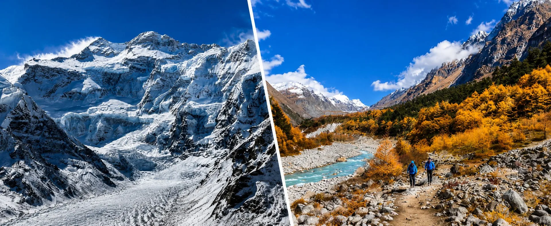
Because the Kanchenjunga massif borders sensitive international frontiers with Tibet (China) and Sikkim (India), the Government of Nepal designates the upper valleys of Taplejung as a Restricted Area. Trekking here is governed by strict Department of Immigration protocols designed to preserve local national security, fragile ecosystems, and indigenous heritage.
In 2026, every foreign trekker must secure two mandatory official permits before stepping foot on the trail. Individual, independent trekking permits are legally impossible to obtain in this sector:
| Permit Name | Government Issuing Body | Official Cost (2026) | Regulatory Rules |
|---|---|---|---|
| Kanchenjunga Restricted Area Permit (KRAP) | Department of Immigration (Maitighar, Kathmandu) | USD $20 per person per week for the first 4 weeks; USD $25/week thereafter | Issued only through a licensed Nepalese trekking agency. Covers Yamphudin, Lelep, Papung, and Olangchung Gola. |
| Kanchenjunga Conservation Area Project (KCAP) | National Trust for Nature Conservation (NTNC) / DNPWC | NPR 3,000 per person (~USD $23) for foreigners; NPR 1,500 for SAARC nationals | Standard single-entry protected area permit. Valid for the duration of the expedition within conservation boundaries. |
The Three Non-Negotiable Immigration Mandates
To receive a valid KRAP paper permit from the Department of Immigration, foreign trekkers must satisfy three stringent legal conditions:
- The Minimum Two-Trekker Rule: The Department of Immigration will never issue a permit to a solo foreign trekker. Applications must contain the original passport details of at least two foreign nationals trekking the identical route simultaneously.
- Mandatory Licensed Mountain Guide: Trekkers must be escorted by a certified, government-licensed Nepali mountain guide from a registered trekking company. Unescorted trekking is strictly prohibited.
- Original Passport Verification: Unlike Annapurna or Everest where digital scans suffice for permits, Kanchenjunga restricted permits require physical verification of original passports with valid Nepal visas at the immigration desk in Kathmandu before permit issuance.
The Severe Dangers of "Ghost Permits"
Some rogue budget operators attempt to circumvent the two-person minimum by creating a "ghost permit"—pairing a solo trekker with an imaginary foreign passport number that does not exist on the trail. Never agree to this practice. Police and army checkpoints at Taplejung, Chirwa, and Yamphudin rigorously verify physical passports against the permit manifest. If your companion is missing, your permit will be confiscated, you will face immediate deportation back to Kathmandu with heavy fines, and your emergency helicopter search-and-rescue insurance will be instantly invalidated.
4. Getting to the Trailhead: Flights to Bhadrapur, Ilam Tea Hills & 4WD Mountain Logistics
Reaching the remote trailheads of Kanchenjunga is an adventure in its own right. While trekkers in Khumbu fly directly into the high mountains at Lukla, Kanchenjunga expeditions begin in the subtropical Terai lowlands of Jhapa and ascend through the emerald tea gardens of the eastern hills.
Option A: Flight to Bhadrapur + 4WD Jeep (Recommended)
The Gold Standard Route: Fly from Kathmandu (TIA) to Chandragadhi Airport in Bhadrapur (BDP) aboard a scheduled commercial jet (Buddha Air or Yeti Airlines). The 45-minute flight flies parallel to the entire Himalayan chain, offering panoramic views of Langtang, Everest, Makalu, and Kanchenjunga.
Because Bhadrapur sits in the flat Terai plains (91m elevation), flights are virtually immune to the sudden mountain cloudbursts and wind shears that ground mountain airstrips. Upon arrival, a private 4WD Mahindra Scorpio takes you up the Mechi Highway through the stunning hillside tea plantations of Kanyam, Ilam, and Phidim to Taplejung (8–9 hours), followed by a 4-hour off-road link to Sekathum.
Option B: Direct STOL Flight to Suketar (High Weather Risk)
The High-Stakes Shortcut: Suketar Airport (2,420m) sits on a high ridge directly above Taplejung bazaar. In theory, a 45-minute Twin Otter flight from Kathmandu eliminates the long drive through the plains.
However, Suketar flights are notoriously unreliable. Flights operate only 2 to 3 days per week during peak season on small STOL aircraft (Nepal Airlines or Tara Air). Clouds frequently engulf the Suketar runway by mid-morning, leading to chronic cancellations and stranded groups. Relying on Suketar flights without buffer days risks missing your entire trekking window.
The 4WD Off-Road Terrain Between Taplejung and Sekathum
In recent years, rough dirt tracks have extended from Taplejung down into the Tamor River canyon, passing through Mitlung and Chirwa to the confluence at Sekathum (1,660m). This road cuts off two days of arduous hiking along dusty jeep roads, allowing you to begin foot trekking in the dramatic granite gorge of the Ghunsa Khola.
However, this track is extremely rugged, featuring exposed cliffside tracks, rocky river crossings, and seasonal mud bogs. Never attempt this section in a standard vehicle; a robust 4WD jeep with high ground clearance and an experienced local eastern mountain driver is essential.
5. North Base Camp Expedition (Pangpema at 5,143m): The Majestic North Face & Glacial Moraines
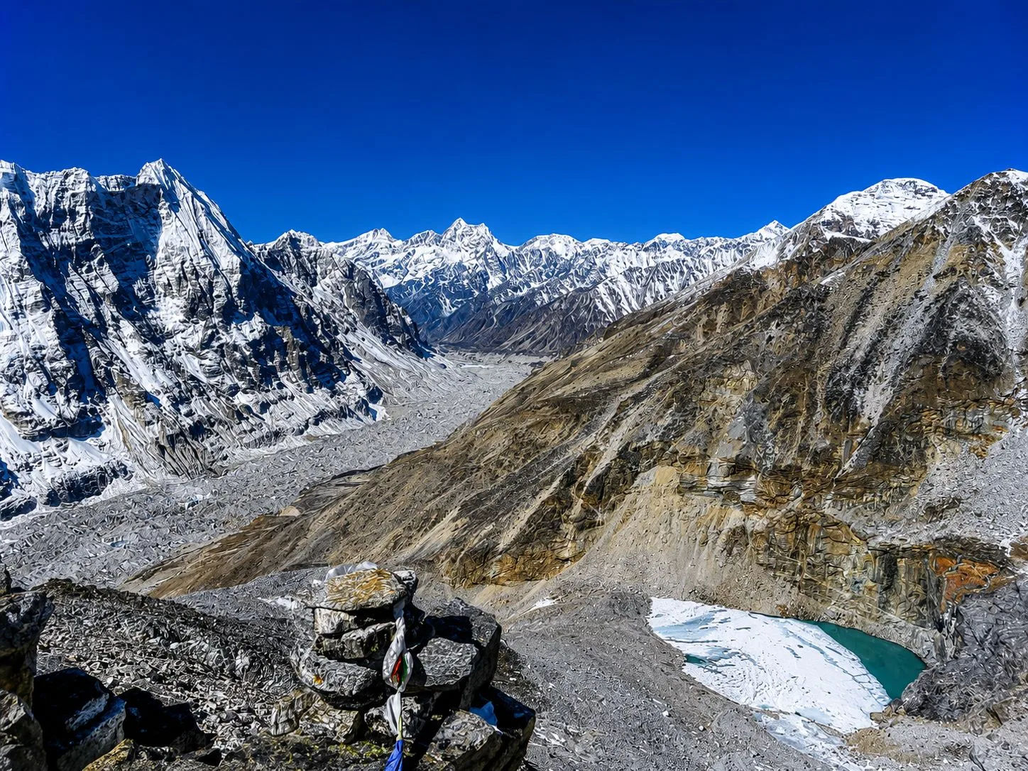
The journey to North Base Camp (Pangpema, 5,143m / 16,873ft) represents one of the most visually staggering achievements in Himalayan trekking. Departing from the stone pastures of Kambachen (4,050m), the trail ascends through rocky glacial valleys where vegetation thins to sparse alpine moss and edelweiss.
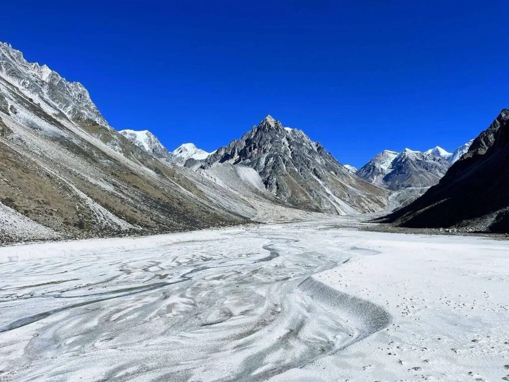
At Lhonak (4,780m), you step into a surreal high-altitude landscape: a vast, windswept dry lakebed of gray sand bordered by colossal lateral moraines and frozen meltwater streams. Lhonak features four basic stone-walled teahouses, serving as the strategic high base for the final push to Pangpema.
The Day Hike to Pangpema: An 18-Kilometer High Alpine Crucible
Most trekkers wake before dawn in Lhonak, pack a thermos of hot ginger tea and energy snacks, and embark on the 7 to 8-hour round-trip trek to Pangpema:
- Moraine Navigation: The trail traces the precarious crumbling crest of the lateral moraine along the colossal Kanchenjunga Glacier. Trekkers must exercise extreme care on sections with loose gravel and active rockfall chutes.
- The Grand Reveal: As you crest the final ridge at Pangpema, the sheer 3,000-meter vertical North Face of Kanchenjunga explodes into view. The scale is staggering—a colossal wall of blue hanging glaciers, sheer fluted ice gullies, and avalanche-scoured granite buttresses.
- The Panoramic Amphitheater: To the left of Kanchenjunga Main (8,586m) stands the jagged silhouette of Yalung Kang (8,505m). Looking northeast along the border ridge, you gaze upon Kirat Chuli (Tent Peak, 7,362m), Nepal Peak (7,177m), and Chang Himal (Wedge Peak, 6,802m).
- Pangpema Memorials: At the viewpoint stands a collection of weathered stone cairns draped in Buddhist prayer flags, honoring the pioneers, sherpas, and mountaineers who challenged this immense mountain face.
After absorbing the immense silence and panoramic grandeur, you descend back down the moraine to the warmth and safety of the Lhonak teahouse before sub-zero temperatures engulf the glacier.
6. South Base Camp Exploration (Oktang & Ramche at 4,730m): The Yalung Glacier Colosseum
While most Himalayan treks feature only a single base camp, the Kanchenjunga Circuit offers the rare privilege of exploring both sides of the mountain. After crossing the high passes into the southern Simbuwa Khola valley, the journey ascends through Cheram (3,870m) toward Oktang South Base Camp (4,730m).
The geographical character of the South Base Camp is strikingly different from the North Face. While Pangpema showcases an intimidating, sheer vertical rock wall, the South Face presents a vast, sprawling colosseum of glacial ice known as the Yalung Glacier.
Reaching Oktang Viewpoint and the Yalung Amphitheater
From Cheram, a gentle morning ascent follows the ablation valley beside the lateral moraine of the Yalung Glacier, passing through the wide alpine pasture of Ramche (4,580m), where herds of blue sheep (bharal) often graze on sub-alpine tussock grass. Continuing another two hours brings you to the sacred vantage point of Oktang (4,730m):
- The Three Colossal Summits: Looking directly up the Yalung Glacier, you witness the three main peaks of the massif aligned in magnificent succession: Kanchenjunga South (8,476m), Kanchenjunga Central (8,482m), and the true summit of Kanchenjunga Main (8,586m).
- The Kabru Fortress: Framing the southern skyline is the imposing ridge of the Kabru peaks (Kabru I, II, III, and IV, rising up to 7,412m), alongside Rathong (6,678m) and Talung (7,349m), forming an impenetrable icy amphitheater.
- The Sacred Shrine: At Oktang, a stone shrine festooned with colorful prayer flags marks the viewpoint. Local herders and mountain guides burn wild juniper branches here to seek blessings and express gratitude to the mountain deities.
Experiencing both Pangpema's vertical drama and Oktang's glacial colosseum gives you an intimate, 360-degree understanding of the immense scale of the world's third-highest peak.
7. The High Pass Traverse: Conquering Sele La, Mirgin La & Sinlapche La (4,660m)
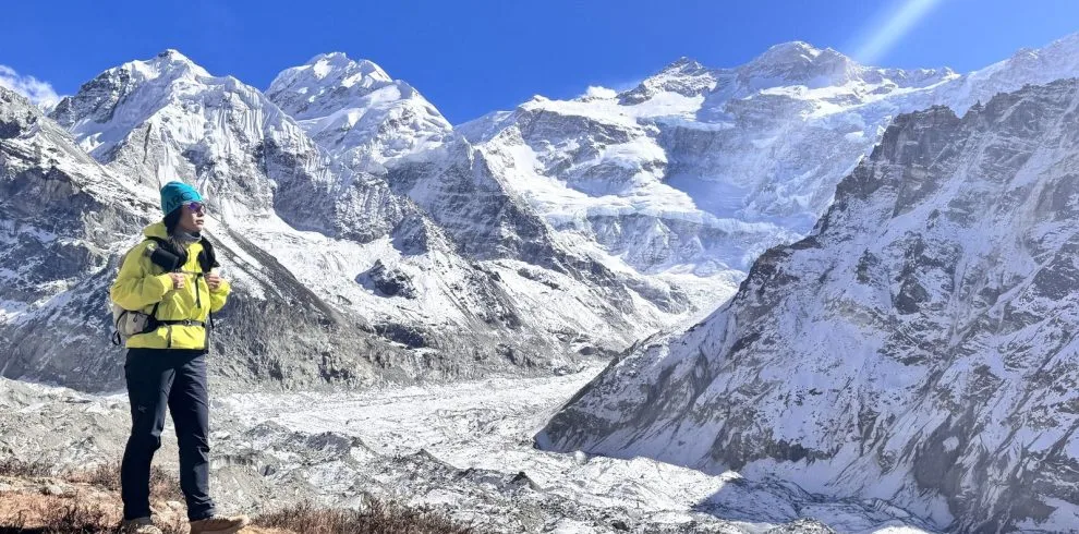
The tactical crux of the Kanchenjunga Circuit is the High Pass Traverse, which connects the northern Ghunsa Khola drainage to the southern Simbuwa Khola basin. Rather than a single mountain pass, this traverse is an undulating alpine ridgeway crossing four distinct high passes in a single demanding day.
| Alpine Pass | Altitude | Terrain Characteristics | Strategic Mountain View |
|---|---|---|---|
| Sele La | 4,290m (14,074 ft) | Steep rocky ascent out of Sele La High Camp through stunted juniper. | Views looking back toward the northern Ghunsa valley and Jannu. |
| Sinion La | 4,440m (14,566 ft) | Exposed ridge col with prayer flags; sharp western winds. | Spectacular western panorama: Mount Makalu (8,485m) & Chamlang (7,319m). |
| Mirgin La | 4,480m (14,698 ft) | Narrow rocky trail hugging steep scree slopes and granite slabs. | Expansive alpine vistas across the eastern ridges and snowfields. |
| Sinlapche La | 4,660m (15,288 ft) | The highest pass on the traverse; windswept cairn and snow cornices. | Dramatic bird's-eye view looking down into the Yalung Glacier moraines. |
Pass Mechanics: Early Departure and Water Management
The traverse from Sele La High Camp to Cheram requires 7 to 8 hours of strenuous, sustained hiking at elevations consistently above 4,200 meters. The day begins at 4:30 AM with a headlamp departure to ensure you cross the highest cols before afternoon winds and fog roll across the ridgeline.
In early spring (April) and late autumn (November), packed snow and patches of black ice frequently coat the narrow scree paths of Sinlapche La. Microspikes and trekking poles are mandatory to prevent dangerous slips on exposed lateral traverses.
Critical Water Advisory for the Pass Day
Between Sele La High Camp and the teahouse at Cheram, there are zero water sources, running streams, or tea shops along the entire 8-hour traverse. Trekkers must carry at least 2.5 to 3.0 liters of drinking water in insulated bottles or thermoses. Water in standard hydration bladders often freezes solid in the hose when exposed to sub-zero summit ridge winds.
8. Acclimatization Strategy & Altitude Safety: Rest Days at Ghunsa & Kambachen
The Kanchenjunga Circuit involves substantial, sustained elevation gains. Between the trailhead at Sekathum (1,660m) and North Base Camp at Pangpema (5,143m), you gain nearly 3,500 vertical meters over 8 trekking days. Ascending too rapidly in this remote wilderness is the number one cause of medical evacuations.
To ensure physiological safety, the itinerary incorporates the proven mountaineering rule: "Climb High, Sleep Low" through two structured acclimatization rest days:
Acclimatization Day 1: Ghunsa (3,595m)
The Altitude Benchmark: Ghunsa is the largest Tibetan settlement in the upper valley. Staying two consecutive nights here allows your body to adjust to sleeping above 3,500m.
Active Conditioning Hike: Spend the morning hiking 400 vertical meters up the southern lateral ridge toward the Yamatari Glacier (reaching ~4,000m). Spend 45 minutes resting at altitude enjoying the panoramic view before descending back to Ghunsa for lunch. In the afternoon, visit the 400-year-old hydro-powered monastery and relax.
Acclimatization Day 2: Kambachen (4,050m)
The Crucial 4,000m Threshold: Before pushing into the extreme alpine zone of Lhonak (4,780m), a second rest day at Kambachen is essential to prevent Acute Mountain Sickness (AMS).
Side Hike to Jannu Base Camp: Undertake an active morning acclimatization hike up the Nuphchu Glacier valley toward the base of Mount Jannu (Kumbhakarna, 7,710m). The sight of Jannu's sheer vertical granite ramparts is breathtaking and stimulates red blood cell production.
Medical Protocols & Evacuation Realities
Every evening, your lead guide will conduct an altitude health check using a pulse oximeter, recording your oxygen saturation (SpO2) and resting pulse. A healthy acclimatized trekker typically maintains SpO2 levels between 75% and 85% at 4,000m.
- Preventative Hydration: Drink between 4 and 5 liters of purified water and hot herbal tea daily. Dehydration mimics and exacerbates altitude sickness.
- Diamox (Acetazolamide): Carrying Diamox (125mg to 250mg twice daily) is recommended for high-altitude acclimatization support. Consult your travel doctor prior to departure.
- Emergency Helicopter Rescue: Taplejung is remote. Helicopter dispatches require satellite phone coordination, good weather, and pre-authorized insurance. Ensure your travel insurance policy explicitly covers unlimited helicopter evacuation up to 6,000 meters without altitude caps.
9. Cultural Tapestry of Eastern Nepal: From Limbu Kirat Foothills to Tibetan Ghunsa
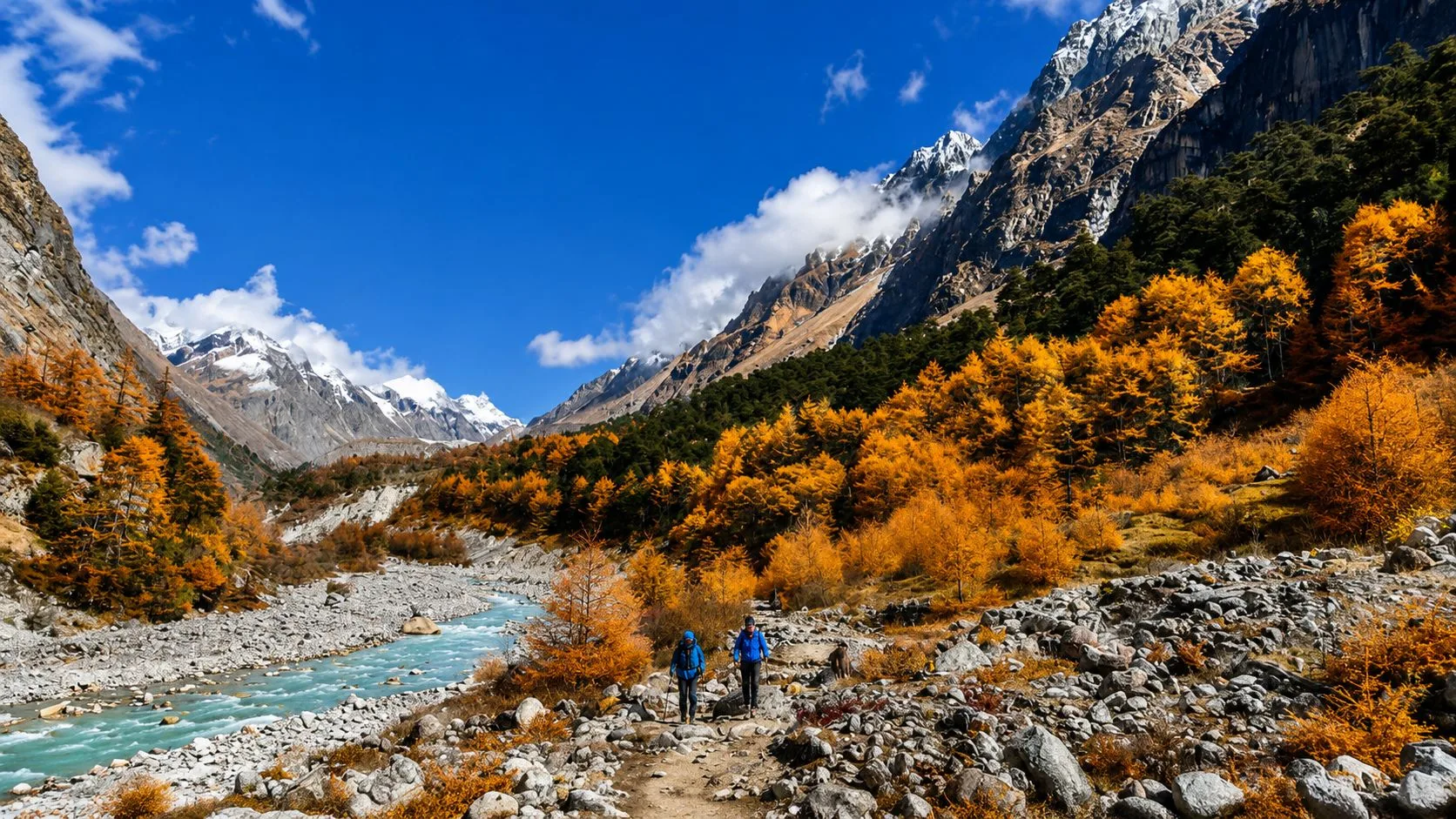
One of the most rewarding aspects of the Kanchenjunga Circuit is its extraordinary cultural progression. While Khumbu is almost exclusively Sherpa and Mustang is culturally Tibetan, Kanchenjunga traverses a vibrant mosaic of distinct ethnic groups and spiritual traditions as you ascend from the subtropical river valleys to the high alpine borderlands.
The Subtropical Foothills: Limbu and Rai Kirat Heritage
In the lower valleys surrounding Taplejung, Chirwa, Sekathum, and Yamphudin, the trail passes through traditional settlements of the Limbu and Rai people, indigenous ethnic groups belonging to the ancient Kirat culture:
- Animist Traditions: The Limbu practice Yuma Samyo, an animist religion honoring nature spirits, sacred mountain deities, and ancestral spirits through stone shrines and shamans (Fedangba).
- Architecture & Cardamom Farming: Villages feature whitewashed clay and bamboo houses with slate roofs, surrounded by lush terraces of large cardamom (alainchi)—the region’s primary cash crop.
- The Ritual of Tongba: The signature cultural experience in Limbu homes is Tongba—warm fermented whole-grain millet served in an ornate wooden vessel with brass bands. Boiling water is poured over the fermented seeds, and the warm, mildly alcoholic nectar is sipped through a perforated bamboo straw called a pipa.
The High Alpine Valleys: Tibetan Bhote and Sherpa Culture
Above Gyabla and Phale, the cultural landscape shifts dramatically to Tibetan Buddhist culture:
- Phale Tibetan Settlement: Phale was established by Tibetan refugees in the 1960s. Women weave vibrant traditional wool carpets on wooden handlooms, and elders turn prayer wheels outside the ancient wooden monastery.
- Ghunsa (The Winter Settlement): Ghunsa is the cultural capital of the upper valley, inhabited by Bhote and Sherpa yak herders. The village features finely carved wooden timber houses, sacred mani stone walls carved with the mantra Om Mani Padme Hum, and colorful fluttering prayer flags (lungta).
- Ancient Trans-Himalayan Salt Route: For centuries, the nearby Walangchung Gola pass served as a vital trade link between eastern Nepal and Shigatse in Tibet, where yak caravans traded grain and cardamom for Tibetan rock salt and wool.
10. Kanchenjunga Conservation Area (KCA) Biodiversity: Red Pandas, Snow Leopards & 30 Rhododendron Species
Established in 1997 and covering 2,035 square kilometers of eastern Nepal, the Kanchenjunga Conservation Area (KCA) is one of the most ecologically diverse protected areas in the entire Himalayan chain. Forming part of the Sacred Himalayan Landscape, it borders the Khangchendzonga National Park in Sikkim to the east and the Qomolangma National Nature Preserve in Tibet to the north, creating a vast transboundary wildlife corridor.
Rare and Endangered Himalayan Wildlife
Because the region experiences minimal human interference and zero vehicular roads in the upper valleys, wildlife flourishes across its diverse bioclimatic zones:
- The Elusive Snow Leopard (Panthera uncia): The rugged glacial moraines surrounding Kambachen, Lhonak, and the Yalung Glacier provide prime habitat for healthy populations of snow leopards, who prey on wild blue sheep (bharal).
- The Red Panda (Ailurus fulgens): In the dense temperate bamboo and mixed deciduous forests between Amjilosa, Gyabla, and Tortong, fortunate trekkers occasionally spot the endangered red panda foraging in tree hollows.
- Himalayan Black Bears & Musk Deer: The mid-elevation oak and fir forests are home to the Himalayan black bear, barking deer, musk deer, and clouded leopards.
- Avian Splendor: The KCA hosts over 250 bird species, including Nepal’s national bird—the iridescent Himalayan Monal (Danphe)—alongside Blood Pheasants, Tibetan Snowcocks, and majestic Lammergeier bearded vultures soaring above alpine cliffs.
The World’s Premier Rhododendron Haven
Eastern Nepal receives the highest rainfall in the country, creating ideal climatic conditions for plant diversity. The KCA is internationally renowned for sheltering over 30 distinct species of rhododendrons.
During the spring bloom (April to early May), the hillsides between Sekathum, Gyabla, and Yamphudin erupt into a breathtaking sea of color, ranging from the scarlet red blooms of Rhododendron arboreum to delicate pink, lavender, and white varieties hanging over roaring river canyons.
11. Teahouse Standards & Homestay Realities: What Daily Life is Really Like in Remote Eastern Lodges
A successful Kanchenjunga trek begins with realistic expectations regarding lodge accommodation. While the Annapurna and Everest circuits now feature luxury lodges with heated electric blankets, espresso machines, and attached western bathrooms, Kanchenjunga remains an authentic, rustic teahouse and homestay experience.
Bedrooms and Sleeping Conditions
Teahouses in villages like Amjilosa, Gyabla, Kambachen, and Lhonak are simple wooden structures managed by local families:
- Twin Rooms: Rooms consist of two wooden single beds with thin foam mattresses, pillows, and cotton sheets. Interior partition walls are made of thin plywood, making earplugs essential for light sleepers.
- Quilts vs. Sleeping Bags: While lodges provide blankets, they are often thin and unwashed. Above Ghunsa (3,595m) and at Lhonak (4,780m), room temperatures drop well below -10°C to -15°C at night. A high-quality 4-season down sleeping bag rated to -15°C or -20°C is non-negotiable.
Bathrooms, Sanitation, and Showers
Sanitation facilities along the circuit reflect the remote environment:
- Toilets: Most teahouses have shared squat toilets located down the hallway or in a small outhouse. In higher camps like Lhonak, basic pit latrines are standard. Always carry your own toilet paper and biodegradable wet wipes, as none are provided.
- Hot Showers: Up to Ghunsa, family lodges provide hot showers heated by gas or wood-fired water boilers for an additional fee of NPR 300 to 500 (~$2 to $4 USD). Above Ghunsa, freezing temperatures make wet bathing dangerous due to hypothermia risks; trekkers rely on sponge baths with hot water bowls and wet wipes.
Electricity, Charging, and Communications
Power management is one of the most critical daily logistics on the circuit:
- Solar Power Realities: Lodges rely exclusively on small solar-battery arrays. Charging a mobile phone or camera battery costs NPR 300 to 500 per charge. During overcast or snowy spells, lodge owners may restrict power to kitchen lighting only.
- Power Bank Strategy: Bring a high-capacity 20,000mAh to 30,000mAh external power bank. At night, always store your power banks, smartphone, and camera batteries inside your sleeping bag to prevent freezing temperatures from draining battery life.
- Cellular Coverage: Nepal Telecom (NTC) has intermittent 2G/3G reception in Taplejung and Ghunsa. Beyond Ghunsa, there is zero cellular signal until you descend to Yamphudin. Guides from Igloo Himalaya Treks carry satellite tracking messengers (Garmin inReach) for emergency communication.
12. Remote Trail Nutrition & Safe Hydration: Fueling 20+ Days in the High Wilderness
Trekking for 6 to 8 hours daily over rugged high-altitude terrain burns between 3,500 and 4,500 calories per day. Maintaining adequate caloric intake and electrolyte balance is vital for warding off exhaustion and altitude-related fatigue.
The King of Himalayan Food: Traditional Dal Bhat
The undisputed staple of every Nepalese mountain expedition is Dal Bhat Tarkari. Served fresh twice daily, this wholesome meal consists of steamed white or brown rice, hearty yellow lentil soup (dal), curried seasonal mountain vegetables (tarkari), sautéed greens (saag), and spicy tomato pickle (achar).
Dal Bhat provides the perfect nutritional balance of complex carbohydrates, plant-based protein, iron, and sodium. Best of all, lodge etiquette includes unlimited free refills of rice, lentils, and vegetables. As the famous Nepalese mountain motto goes: "Dal Bhat Power, 24 Hour!"
Regional Mountain Specialities on the Trail
Beyond Dal Bhat, upper-valley teahouses offer hearty Sherpa and Tibetan comfort food:
- Sherpa Stew (Syakpa): A thick, warming stew made with handmade flour dough dumplings, potatoes, carrots, radish, and wild mountain herbs.
- Tsampa Porridge: Roasted Tibetan barley flour cooked with milk or water, eaten by Sherpa guides for sustained morning endurance.
- Tibetan Bread & Pancakes: Deep-fried or pan-baked flatbread served with honey, peanut butter, or yak cheese.
- Gur Gur Cha (Salt-Butter Tea): Churned black tea blended with yak butter and Himalayan rock salt, providing vital lipids and electrolytes in sub-zero alpine camps.
The Strict Vegetarian Rule Above Ghunsa
Because there is no electricity or refrigeration in remote high camps, any meat served at Kambachen or Lhonak has been transported on porters' backs in warm sacks for several days. Consuming chicken, pork, or buffalo at altitude carries severe risks of bacterial food poisoning. Stick to a strictly vegetarian diet above Ghunsa (3,595m) to keep your digestive system healthy.
Safe Hydration Protocols
At high elevations, hyperventilation and dry mountain air cause rapid fluid loss. Trekkers should drink a minimum of 4 to 5 liters of fluid per day:
- Never Drink Raw Water: Never drink untreated stream or tap water. Treat all drinking water using a portable SteriPEN UV purifier or chlorine dioxide chemical purification tablets (such as Aquatabs or Katadyn Micropur).
- The Nalgene Bed-Warmer Trick: Order 1 liter of boiling water in your wide-mouth Nalgene bottle before going to bed. Slip the hot bottle into your sleeping bag to warm your feet through the sub-zero night; by morning, you have a liter of clean, purified drinking water ready for the trail.
13. Best Seasons & Optimal Weather Windows: Autumn vs. Spring Tactical Comparison
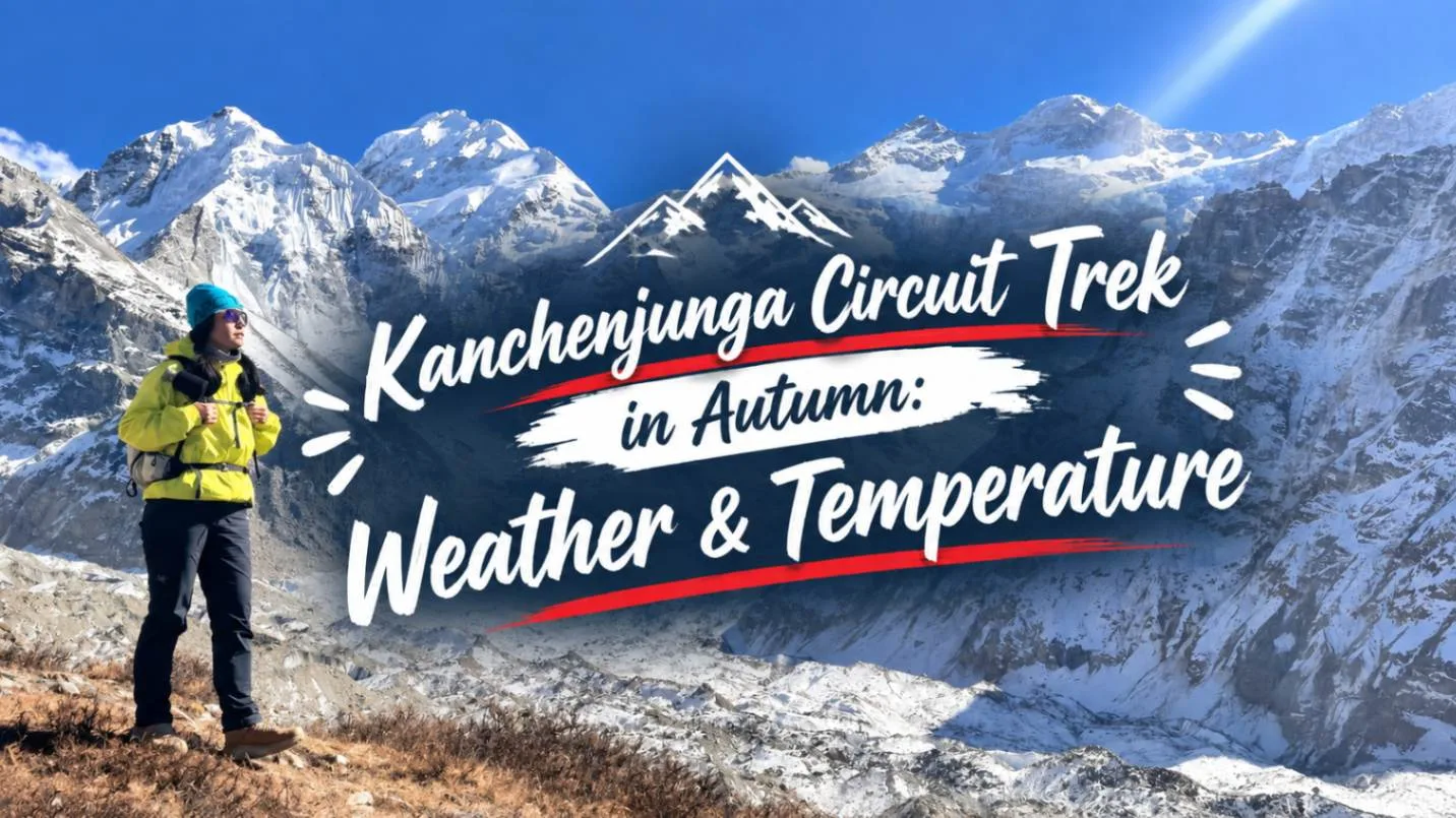
Because Eastern Nepal is positioned closer to the Bay of Bengal than the western regions of Nepal, it receives the summer monsoon earlier and experiences higher total rainfall. Choosing the right seasonal window is crucial for pass safety and panoramic visibility.
| Trekking Season | Daytime Temperatures | Nighttime Temperatures | Trail Conditions & Visibility | High Pass Viability |
|---|---|---|---|---|
| Autumn (Oct – Nov) The Premier Window |
10°C to 16°C (lower valleys) 0°C to 5°C (Lhonak) |
-5°C to -15°C at high camps | Dry, firm trails; exceptional crystal-clear mountain visibility; minimal rain. | Optimal. Passes generally free of deep snowdrifts through mid-November. |
| Spring (Mid-Mar – May) Wildflowers & Rhododendrons |
12°C to 18°C (lower valleys) 2°C to 7°C (Lhonak) |
-2°C to -10°C at high camps | Spectacular rhododendron blooms; warmer days; afternoon convective clouds. | Good. Residual winter snow on passes; microspikes usually necessary. |
| Winter (Dec – Feb) Extreme Cold & Pass Blockage |
2°C to 8°C (lower valleys) -10°C to -5°C (Lhonak) |
-20°C to -25°C at high camps | Bitter sub-zero temperatures; intense freeze-thaw cycles; heavy snowdrifts. | Impasse. Sele La and Mirgin La blocked by deep snow; teahouses closed. |
| Monsoon (Jun – Early Sep) Heavy Rainfall & Landslides |
18°C to 24°C (lower valleys) 8°C to 14°C (high camps) |
5°C to 10°C at high camps | Torrential rain, rampant leeches, severe mudslides on Mechi Highway; cloudy. | Dangerous. Unstable scree, swollen river crossings; not recommended. |
The Expert Verdict: Why October to Mid-November is Best
For the complete circuit, mid-October through late November is the undisputed golden window. The monsoon atmosphere washes out, leaving diamond-sharp air with visibility exceeding 100 kilometers. Nighttime temperatures are cold, but high passes are dry and safe. Spring (April) is wonderful for botany enthusiasts, but lingering winter snow on Sinlapche La often requires mountaineering traction.
14. Physical Demands & Endurance Conditioning: Preparing for 220+ Kilometers of Rugged Wilderness
The Kanchenjunga Circuit is physically demanding. You will hike for 20 consecutive days, traverse over 220 kilometers of rugged terrain, and accumulate more than 12,000 meters of cumulative elevation gain and loss. There are no rest days with motorized transport to save weary legs.
Key Physiological Demands
Trekking here requires three distinct physical attributes:
- Aerobic Endurance: The ability to sustain low-to-moderate cardiovascular output for 6 to 8 hours daily at altitudes where oxygen levels drop to 50% of sea level.
- Eccentric Knee & Quad Resilience: The circuit features brutal descents—such as the 1,500m knee-jarring drop from Sinlapche La to Cheram, and the steep descent from Lasiya Bhanjyang to Yamphudin. Strong quadriceps and calves prevent patellar tendonitis.
- Core & Back Stability: Carrying a 6–8kg technical daypack containing water, extra layers, first aid, and camera gear over steep, uneven boulder scree requires a robust core.
12-Week Progressive Conditioning Blueprint
Trekkers should initiate dedicated training at least 3 months prior to arrival in Nepal:
- Weeks 1–4 (Aerobic Foundation): 3 days per week of Zone 2 cardio (hiking, cycling, trail jogging, or rowing) for 45 minutes at a conversational pace. 2 days of strength training focusing on goblet squats, Romanian deadlifts, lunges, and calf raises.
- Weeks 5–8 (Loaded Incline Training): 3 days of stairmaster or steep incline treadmill walking (12–15% incline) wearing a 6kg weighted vest or backpack for 60 minutes. Weekend outdoor trail hikes of 3 to 4 hours on hilly terrain.
- Weeks 9–11 (Peak Mountain Simulation): Back-to-back weekend trail hikes of 5 to 6 hours wearing your broken-in trekking boots and carrying an 8–10kg backpack. Focus on steady pacing and downhill walking technique with trekking poles.
- Week 12 (Tapering & Recovery): Reduce training volume by 50%. Focus on stretching, joint mobility, foam rolling, proper hydration, and restful sleep before your international flight.
15. Comprehensive Expedition Packing List: Crucial Cold-Weather Gear & Power Management
Packing for the Kanchenjunga Circuit requires balancing comprehensive cold-weather protection with weight discipline. Porters typically carry a waterproof duffel bag capped at 15 to 18 kilograms per trekker, while you carry a 30–35L technical daypack weighing 5 to 7 kilograms.
| Gear Category | Essential Items & Specifications | Field Recommendations |
|---|---|---|
| 4-Layer Clothing System |
• 2x Merino wool base layer tops & bottoms (200–260 gsm) • 1x Mid-layer Polartec fleece or grid fleece jacket • 1x Heavyweight expedition down jacket (800+ fill power, -20°C rated) • 1x 3-layer Gore-Tex Pro waterproof/windproof shell jacket & pants • 2x Quick-dry trekking trousers + 1x fleece-lined softshell pants |
Avoid cotton entirely ("Cotton Kills"). Layering allows rapid thermal regulation. |
| Footwear & Traction |
• Sturdy, high-cut waterproof trekking boots (Vibram soles, Gore-Tex) • Kahtoola MICROspikes or lightweight trail crampons • 5x Heavyweight merino wool trekking socks + 2x thin sock liners • Lightweight camp shoes (sandals with down socks or running shoes) |
Boots must be thoroughly broken in 2 months prior to avoid crippling blisters. |
| Sleeping Equipment |
• 4-season down sleeping bag (Comfort rating: -15°C to -20°C / 0°F) • Silk or thermal fleece sleeping bag liner (adds 3–5°C warmth) • Inflatable camp pillow & earplugs |
Teahouse quilts at Lhonak and Pangpema are insufficient during sub-zero nights. |
| Optics, Power & Safety |
• Category 4 glacier sunglasses with protective side shields • 20,000 to 30,000 mAh high-capacity rugged power bank • 300+ lumen headlamp with spare rechargeable batteries • 2x 1L wide-mouth Nalgene water bottles + insulated thermal sleeves |
Category 4 eyewear is mandatory against snow blindness on glacial moraines. |
| Medical & Hygiene Kit |
• Personal medical kit: Diamox, Cipro, Ibuprofen, Pepto-Bismol • Blister kit: Compeed hydrocolloid patches, Leukotape, sterile needle • Water purification: SteriPEN UV + chlorine dioxide tablets • Biodegradable wet wipes, hand sanitizer, high-SPF sunscreen, zinc lip balm |
Keep blister care and rehydration salts easily accessible in your daypack. |
Frequently Asked Questions (FAQ) About the Kanchenjunga Circuit Trek
Select a category below to explore expert answers to the most common questions travelers ask about Kanchenjunga Circuit Trek 2026 Guide:
Difficulty & Fitness
Ready to Experience the Himalayas?
Whether you are preparing for high-altitude trekking, cultural circuits, or alpine summit expeditions, start planning a bespoke journey tailored to your fitness, travel season, and style.